Acadia Parish Chamber of Commerce and Economic Development’s Site Development program is designed to increase the region’s portfolio of marketable, development-ready sites by certifying land within our parish. This is achieved through partnering between APCCED, One Acadiana, and land owners.
What is a Certified Site?
A Louisiana Economic Development Certified Site is a development-ready site that has completed a rigorous review process to answer as many development questions as possible. The program is designed to assess specific site details for compliance and authenticity. All certified sites are 180-day development ready, offering the additional advantage of ensuring that the client’s construction is more likely to remain on schedule.
Louisiana Economic Development’s Certified Industrial Site Program focuses on sites intended for industrial or manufacturing uses. To qualify for the industrial site program, sites must have a minimum of 25 contiguous, unencumbered acres available for development.
Louisiana Economic Development’s Certified Business Site Program targets sites best suited for business parks, mixed use developments, or Planned Unit Developments (PUD). Sites qualifying for this program will have between 10 and 25 contiguous, unencumbered acres available for development.
Extensive Review Process
- Zoning restrictions
- Title work
- Environmental studies
- Soil analysis
- Surveys
The due diligence performed during the certified sites process delivers a property with minimal uncertainty through enhanced site knowledge. This allows One Acadiana to present more competitive, marketable sites to potential companies during the business development process.
Advantages of Certification
- Development ready
- Substantial due diligence completed
- Significant site information gathered and documented
- Independent third-party engineering review
- Eliminated uncertainty and potential obstacles through site knowledge
- More competitive
- Greater marketability
- Granted priority in site proposal
Sites and Infrastructure
Acres of Opportunity
If your company is looking to relocate or expand in South Louisiana, our staff will help you navigate the site selection process. We understand the challenges of the site location process in today’s fast pace economy. Armed with experience and the latest site location tools and services, APCCED is ready to assist your company with locating or expanding in the parish. Whether you’re looking for available sites or existing buildings, when it comes time to find the best location for your operation, look no further than Acadia Parish.
Site Selection Tool
One Acadiana is excited to provide GIS planning resources for regional location and development activities. Geographic Information Science (GIS) is an ever-growing discipline that combines database information with geographic features for powerful display and analysis. The regional map illustrates data sets related to flood zones, wetlands, incentives (e.g. Opportunity Zones, New Market Tax Credits, etc.), demographics, and other developmental concerns, allowing the user to choose the most ideal location for their operation. Our GIS tool also includes real-estate listings that can be sorted by size (e.g. square feet or acres), existing building or greenfield site, and intended use (e.g., Industrial, Commercial).
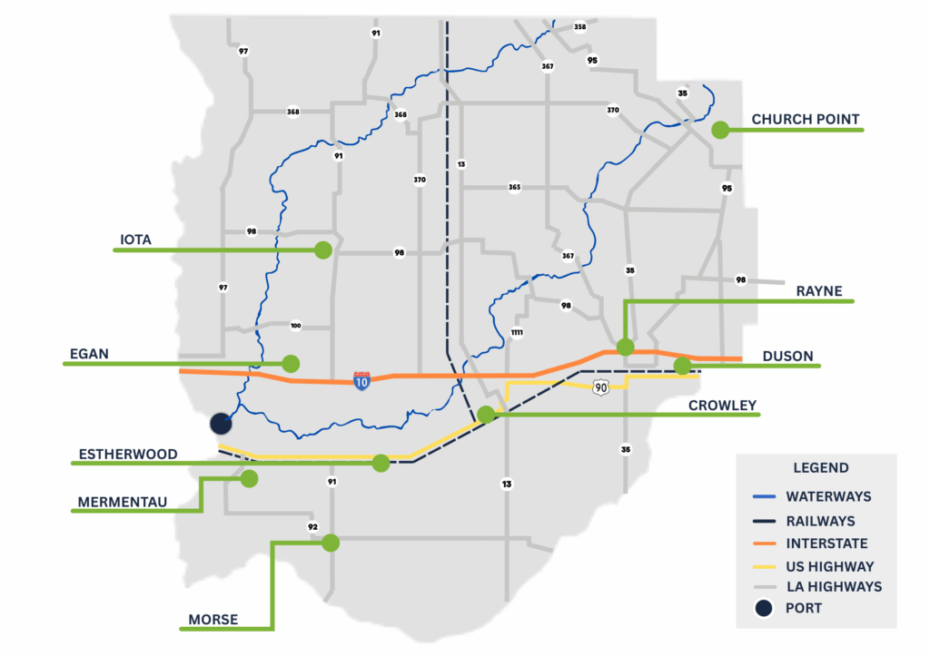
Infrastructure Map


